2012
TL8388 : Milestone by the A134
taken 12 years ago, 3 km from Santon Downham, Suffolk, England
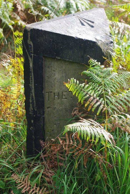
Milestone by the A134
Four miles to Thetford. The arrowed rivet on the top is an Ordnance Survey benchmark which was once 29.2715 metres above Ordnance Datum. Given TL8388 : Damaged Milestone in 2009, I suspect that's no longer accurate.
 Map © Crown Copyright")
TIP: Click the map for more Large scale mapping
- Grid Square
- TL8388, 27 images (more nearby 🔍)
- Photographer
- Ben Harris (more nearby)
- Date Taken
- Tuesday, 2 October, 2012 (more nearby)
- Submitted
- Saturday, 13 October, 2012
- Subject Location
-
OSGB36:
 TL 838 888 [100m precision]
WGS84: 52:28.0189N 0:42.3211E - Camera Location
-
OSGB36: TL 838 888
- View Direction
- South-southeast (about 157 degrees)