J3574 : Former Rupert Stanley College, Belfast (2)
taken 12 years ago, near to Belfast, Co Antrim, Northern Ireland
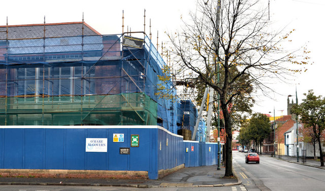
Former Rupert Stanley College, Belfast (2)
See J3574 : Former Rupert Stanley College, Belfast (May 2010). The building is now undergoing renovation and conversion. J3574 : Former Rupert Stanley College, Belfast (3) (July 2013) shows the building after completion of the restoration work.
Templemore Avenue, Belfast
A long street running from the Castlereagh Road/Beersbridge Road, across the Albertbridge Road to the Newtownards Road It developed over a number of years from the late 19th century. In 1880 it had only three houses.
![Creative Commons Licence [Some Rights Reserved]](https://s1.geograph.org.uk/img/somerights20.gif)
|
· Find out How to reuse this image ·
Share:
|
|||||
| Start a discussion on J3574 | Suggest an update to this image | Contact the contributor | |||
Loading map... (JavaScript required)
- Grid Square
- J3574, 516 images (more nearby
 )
)
- Photographer
- Albert Bridge (find more nearby)
- Date Taken
- Sunday, 14 October, 2012 (more nearby)
- Submitted
- Sunday, 14 October, 2012
- Geographical Context
- Subject Location
-
Irish:
 J 356 741 [100m precision]
WGS84: 54:35.8265N 5:54.1245W - Camera Location
-
Irish: J 356 741
- View Direction
- NORTH (about 0 degrees)
Other Tags
Image classification(about):
Geograph
This page has been viewed about 325 times.
View this location:
KML (Google Earth) ·
Google Maps ·
Bing Maps ·
Geograph Coverage Map ·
More Links for this image
·
Bing Maps ·
Geograph Coverage Map ·
More Links for this image