2007
TF4728 : Disused Military Building Near Gedney Drove End
taken 17 years ago, near to Gedney Drove End, Lincolnshire, England
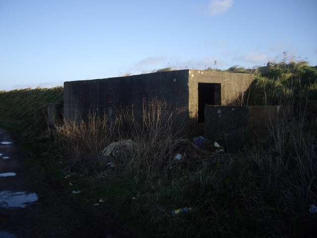
Disused Military Building Near Gedney Drove End
This stretch of Coastline is littered with many 'pill box' type concrete structures. To all intents and purposes, it looked as though this one had squatters!
 Map © Crown Copyright")
TIP: Click the map for more Large scale mapping
- Grid Square
- TF4728, 20 images (more nearby 🔍)
- Photographer
- Tim Hallam (more nearby)
- Date Taken
- Monday, 22 January, 2007 (more nearby)
- Submitted
- Monday, 22 January, 2007
- Subject Location
-
OSGB36:
 TF 479 283 [100m precision]
WGS84: 52:49.9632N 0:11.6931E - Camera Location
-
OSGB36: TF 479 284
- View Direction
- South-southeast (about 157 degrees)