2007
SO0814 : Cwar yr Ystrad (limestone quarry)
taken 17 years ago, 3 km from Abercynafon, Powys, Wales
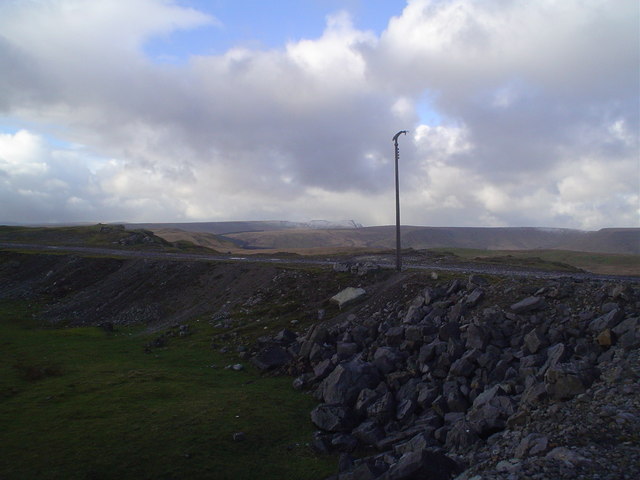
Cwar yr Ystrad (limestone quarry)
At more than 500 metres above sea level, descending on foot from the remote summit of Garn Felen, it's rather surprising to come across a concrete lamp standard. It once helped to illuminate access to the upper quarries of a complex that may be reached via progressively rougher roads from the signpost to Trefil, off a roundabout on the A465 'Heads of the Valleys' road. In this area there is an interesting juxtaposition of the abandoned limestone quarry workings and the natural beauty of the distant central Brecon Beacons ridges.
 Map © Crown Copyright")
TIP: Click the map for more Large scale mapping
- Grid Square
- SO0814, 30 images (more nearby 🔍)
- Photographer
- Nic Howes (more nearby)
- Date Taken
- Sunday, 21 January, 2007 (more nearby)
- Submitted
- Wednesday, 24 January, 2007
- Subject Location
-
OSGB36:
 SO 085 146 [100m precision]
WGS84: 51:49.3502N 3:19.7391W - Camera Location
-
OSGB36: SO 085 146
- View Direction
- Northwest (about 315 degrees)