J3958 : Drumlin and trees, Saintfield
taken 11 years ago, near to Saintfield, Co Down, Northern Ireland
Drumlin and trees, Saintfield
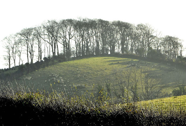
Trees on a drumlin between the Ballynahinch and Listooder Roads. From a distance they resemble a rath but on closer inspection (confirmed by the satellite photograph) the trees are simply growing in a line across the top. See also J3958 : Drumlin, Saintfield - April 2016(2).
![Creative Commons Licence [Some Rights Reserved]](https://s1.geograph.org.uk/img/somerights20.gif)
|
· Find out How to reuse this image ·
Share:
|
|||||
| Start a discussion on J3958 | Suggest an update to this image | Contact the contributor | |||
Loading map... (JavaScript required)
- Grid Square
- J3958, 14 images (more nearby
 )
)
- Photographer
- Albert Bridge (find more nearby)
- Date Taken
- Friday, 7 December, 2012 (more nearby)
- Submitted
- Friday, 7 December, 2012
- Geographical Context
- Subject Location
-
Irish:
 J 399 580 [100m precision]
WGS84: 54:27.0796N 5:50.6126W - Camera Location
-
Irish: J 398 583
- View Direction
- SOUTH (about 180 degrees)
Other Tags
Image classification(about):
Geograph
This page has been viewed about 60 times.
View this location:
KML (Google Earth) ·
Google Maps ·
Bing Maps ·
Geograph Coverage Map ·
More Links for this image
·
Bing Maps ·
Geograph Coverage Map ·
More Links for this image