2006
ST4677 : Silt erosion
taken 17 years ago, near to Portishead, North Somerset, England
Silt erosion
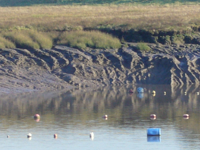
South of Port's Head the beach erodes slowly, William Carter researched this for a dissertation, but the extent of vegetation decline (marram grass) and the chemical, ship wash and storm wave pattern changes and the diverted sewer overflow and retained lake overflow have added to the rainfall offshore drainage and the backwash from tidal inundation and onshore swell. The offshore is lethal quicksand and steep, to one of the five fastest ebb flows, extremely dangerous. The history of Portishead beaches is gradually being revealed near the shore esplanade top side. 14:26 tide.
 Map © Crown Copyright")
TIP: Click the map for more Large scale mapping
- Grid Square
- ST4677, 209 images (more nearby 🔍)
- Photographer
- MDS (more nearby)
- Date Taken
- Friday, 3 November, 2006 (more nearby)
- Submitted
- Monday, 5 February, 2007
- Subject Location
-
OSGB36:
 ST 463 772 [100m precision]
WGS84: 51:29.4982N 2:46.4574W - Camera Location
-
OSGB36: ST 464 773
- View Direction
- South-southwest (about 202 degrees)