S7010 : Approaching Passage East
taken 31 years ago, near to Passage East, Co Waterford, Ireland
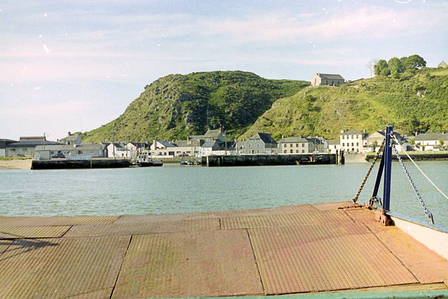
Approaching Passage East
This neat local ferry crosses the River Suir and cuts out a 35 mile road trip.
![Creative Commons Licence [Some Rights Reserved]](https://s1.geograph.org.uk/img/somerights20.gif)
|
· Find out How to reuse this image ·
Share:
|
|||||
| Start a discussion on S7010 | Suggest an update to this image | Contact the contributor | |||
Loading map... (JavaScript required)
- Grid Square
- S7010, 53 images (more nearby
 )
)
- Photographer
- Stuart Logan (find more nearby)
- Date Taken
- May 1993 (more nearby)
- Submitted
- Wednesday, 23 January, 2013
- Geographical Context
- Subject Location
-
Irish:
 S 702 102 [100m precision]
WGS84: 52:14.4152N 6:58.3584W - Camera Location
-
Irish: S 703 104
- View Direction
- Southwest (about 225 degrees)
This page has been viewed about 53 times.
View this location:
KML (Google Earth) ·
Google Maps ·
Bing Maps ·
Geograph Coverage Map ·
More Links for this image
·
Bing Maps ·
Geograph Coverage Map ·
More Links for this image