2005
NS9161 : Railways galore
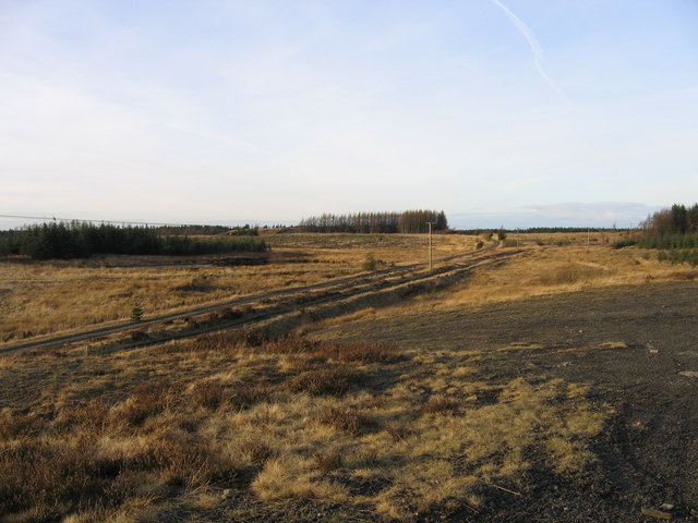
taken 18 years ago, near to Fauldhouse, West Lothian, Scotland
Railways galore
The complexity of railway networks brought about by competition between Victorian railway companies is well seen here. Running side by side are the Caledonian Railway (left-hand) and North British Railway (right-hand) branches to former ironstone and coal pits in the Benhar and Polkemmet area between Fauldhouse and Whitburn. In the distance they can be seen diverging apart but after about a mile they came back together to serve Polkemmet Colliery. Both lines threw off short branches to various other pits, the course of one off the Caledonian line being just visible as a low embankment in front of the belt of trees on the left. To the left of the trees in the far centre distance can be seen another partly grassed-over waste bing and this was also served by branches from the Caley line.
 Map © Crown Copyright")
TIP: Click the map for more Large scale mapping
- Grid Square
- NS9161, 20 images (more nearby 🔍)
- Photographer
- A-M-Jervis (more nearby)
- Date Taken
- Saturday, 17 December, 2005 (more nearby)
- Submitted
- Monday, 11 February, 2013
- Subject Location
-
OSGB36:
 NS 9163 6134 [10m precision]
WGS84: 55:49.9849N 3:43.9057W - Camera Location
-
OSGB36: NS 9177 6120
- View Direction
- Northwest (about 315 degrees)