X1290 : Road signs in Aglish
taken 11 years ago, near to Aglish, Co Waterford, Ireland
Road signs in Aglish
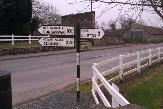
In the centre of the village of Aglish is a direction post. While distances in Ireland are mostly indicated in kilometres these days, if a sign is old and doesn't have Km after the figure, you will find that generally these distances are still recorded in miles.
![Creative Commons Licence [Some Rights Reserved]](https://s1.geograph.org.uk/img/somerights20.gif)
|
· Find out How to reuse this image ·
Share:
|
|||||
| Start a discussion on X1290 | Suggest an update to this image | Contact the contributor | |||
Loading map... (JavaScript required)
- Grid Square
- X1290 (more nearby
 )
)
- Photographer
- Hywel Williams (find more nearby)
- Date Taken
- Sunday, 24 March, 2013 (more nearby)
- Submitted
- Monday, 25 March, 2013
- Geographical Context
- Subject Location
-
Irish:
 X 121 908 [100m precision]
WGS84: 52:4.1720N 7:49.4565W - Camera Location
-
Irish: X 121 908
- View Direction
- Southeast (about 135 degrees)
This page has been viewed about 105 times.
View this location:
KML (Google Earth) ·
Google Maps ·
Bing Maps ·
Geograph Coverage Map ·
More Links for this image
·
Bing Maps ·
Geograph Coverage Map ·
More Links for this image