D4101 : The Curran, Larne (2)
taken 18 years ago, near to Ballylumford, Co Antrim, Northern Ireland
The Curran, Larne (2)
See D4101 : The Curran, Larne (November 2011). An earlier and elevated view of The Curran from the Carrickfergus Road. To the best of my knowledge the jetty (lower right) once served a small shipyard in the early part of the 20th century. There was also a coal-fired power station on the point.
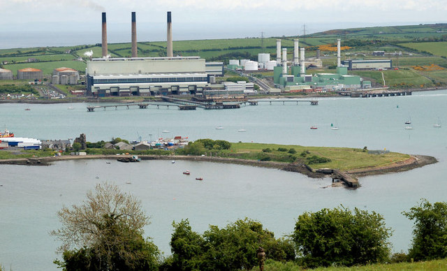
Ballylumford power stations, Islandmagee :: D4202
Two power stations (one oil-fired, the other gas-fired) at the north western end of Islandmagee.
![Creative Commons Licence [Some Rights Reserved]](https://s1.geograph.org.uk/img/somerights20.gif)
|
· Find out How to reuse this image ·
Share:
|
|||||
| Start a discussion on D4101 | Suggest an update to this image | Contact the contributor | |||
Loading map... (JavaScript required)
- Grid Square
- D4101, 45 images (more nearby
 )
)
- Photographer
- Albert Bridge (find more nearby)
- Date Taken
- Tuesday, 23 May, 2006 (more nearby)
- Submitted
- Sunday, 31 March, 2013
- Geographical Context
- Former (from Tags)
- Subject Location
-
Irish:
 D 413 015 [100m precision]
WGS84: 54:50.4952N 5:48.0306W - Camera Location
-
Irish: D 402 011
- View Direction
- East-northeast (about 67 degrees)
Other Tags
Image classification(about):
Supplemental image
This page has been viewed about 114 times.
View this location:
KML (Google Earth) ·
Google Maps ·
Bing Maps ·
Geograph Coverage Map ·
More Links for this image
·
Bing Maps ·
Geograph Coverage Map ·
More Links for this image