1966
SK0380 : Eastward on A625 at Tunstead Milton towards Chapel-en-le-Frith and the High Peak, 1966
taken 58 years ago, near to Combs, Derbyshire, England
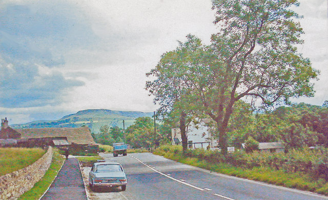
Eastward on A625 at Tunstead Milton towards Chapel-en-le-Frith and the High Peak, 1966
The peak ahead is Bee Low (1,368 ft.). The road is now B5470.
 Map © Crown Copyright")
TIP: Click the map for more Large scale mapping
- Grid Square
- SK0380, 35 images (more nearby 🔍)
- Photographer
- Ben Brooksbank (more nearby)
- Date Taken
- 27 July 1966 (more nearby)
- Submitted
- Tuesday, 2 April, 2013
- Subject Location
-
OSGB36:
 SK 034 800 [100m precision]
WGS84: 53:19.0368N 1:56.9895W - Camera Location
-
OSGB36: SK 034 800
- View Direction
- EAST (about 90 degrees)