2012
SE4105 : Sandstone causey
taken 12 years ago, near to Darfield, Barnsley, England
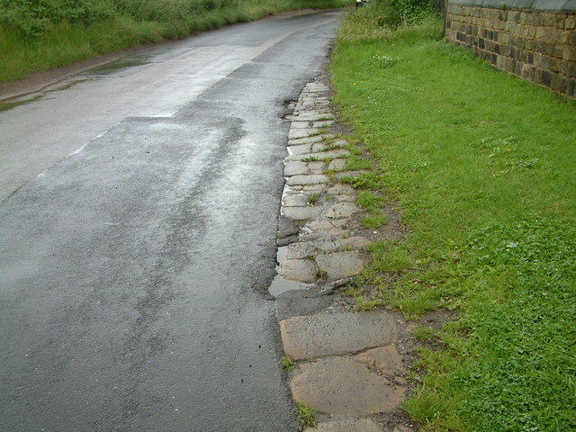
Sandstone causey
An example of a local stone causey (or pavement) laid to reduce the wear on the otherwise soft road surface by pack-horses. The trust maintaining the nearby Doncaster to Saltersbrook turnpike road were laying just such pavements on parts of their road between Marr and Darfield around 1740 to 1760.
There is quite a lot more of this causey heading towards Cudworth, before Crookes Farm, emerging from under the modern tarmacadam covering. The lane leads to the pack-horse bridge and staircase at Storrs Wood by the river Dearne adjacent to Cudworth.
There is quite a lot more of this causey heading towards Cudworth, before Crookes Farm, emerging from under the modern tarmacadam covering. The lane leads to the pack-horse bridge and staircase at Storrs Wood by the river Dearne adjacent to Cudworth.
 Map © Crown Copyright")
TIP: Click the map for more Large scale mapping
- Grid Square
- SE4105, 86 images (more nearby 🔍)
- Photographer
- John Orchard (more nearby)
- Date Taken
- Sunday, 29 July, 2012 (more nearby)
- Submitted
- Tuesday, 9 April, 2013
- Subject Location
-
OSGB36:
 SE 411 057 [100m precision]
WGS84: 53:32.8178N 1:22.8536W - Camera Location
-
OSGB36: SE 411 057
- View Direction
- WEST (about 270 degrees)