2003
ST2687 : Iron Age Fort near Rhiwderin
taken 20 years ago, near to Rhiwderin, Newport/Casnewydd, Wales
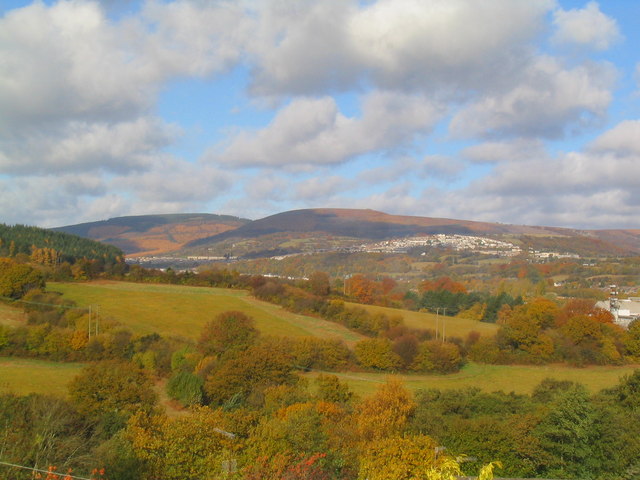
Iron Age Fort near Rhiwderin
The fort is situated at the North Eastern corner of the large field in the central left of the photograph. An additional hill fort can be seen at the summit of the hill, known as Twmbarlwm, in the near distance.
 Map © Crown Copyright")
TIP: Click the map for more Large scale mapping
- Grid Square
- ST2687, 156 images (more nearby 🔍)
- Photographer
- Graham Price (more nearby)
- Date Taken
- Monday, 3 November, 2003 (more nearby)
- Submitted
- Sunday, 18 February, 2007
- Subject Location
-
OSGB36:
 ST 264 877 [100m precision]
WGS84: 51:35.0162N 3:3.8101W - Camera Location
-
OSGB36: ST 266 873
- View Direction
- North-northwest (about 337 degrees)