2013
TG5108 : Floodbank improvements
taken 11 years ago, near to Great Yarmouth, Norfolk, England
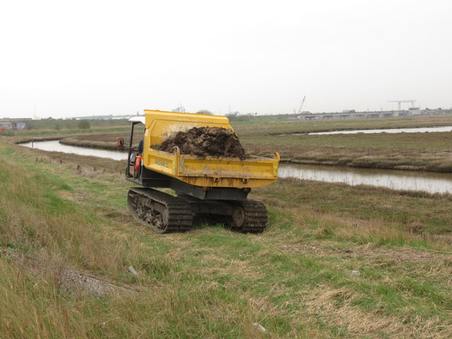
Floodbank improvements
Transferring material along the edge of Breydon Water as part of the Broadland Flood Alleviation Project Link Work to improve a 1.2km length of bank from the A12 Breydon bridge started in April 2013.
 Map © Crown Copyright")
TIP: Click the map for more Large scale mapping
- Grid Square
- TG5108, 246 images (more nearby 🔍)
- Photographer
- Jeremy Halls (more nearby)
- Date Taken
- Thursday, 25 April, 2013 (more nearby)
- Submitted
- Saturday, 27 April, 2013
- Subject Location
-
OSGB36:
 TG 5157 0867 [10m precision]
WGS84: 52:37.0482N 1:42.8989E - Camera Location
-
OSGB36: TG 5155 0869
- View Direction
- South-southeast (about 157 degrees)