W0091 : Tiernaboul, Killarney, Co. Kerry, Ireland
taken 17 years ago, 4 km SSE of Kilcummin, Co Kerry, Ireland
This is 1 of 2 images, with title Tiernaboul, Killarney, Co. Kerry, Ireland in this square
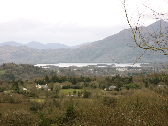
Tiernaboul, Killarney, Co. Kerry, Ireland
A little further up the road than my other photo. Lough Leane is in the middle distance with Rough Island on the right of the lough and Cow Island to the left. The mountains are MacGillycuddy's Reeks. Killarney Town would be to the right.
![Creative Commons Licence [Some Rights Reserved]](https://s1.geograph.org.uk/img/somerights20.gif)
|
· Find out How to reuse this image ·
Share:
|
|||||
| Start a discussion on W0091 | Suggest an update to this image | Contact the contributor | |||
Loading map... (JavaScript required)
- Grid Square
- W0091, 2 images (more nearby
 )
)
- Photographer
- Peter Gerken (find more nearby)
- Date Taken
- Sunday, 18 February, 2007 (more nearby)
- Submitted
- Wednesday, 21 February, 2007
- Category
- View > Viewpoint (more nearby)
- Subject Location
-
Irish:
 W 00 91 [1000m precision]
WGS84: 52:4.0212N 9:27.1003W - Camera Location
-
Irish: W 00 91
- View Direction
- Southwest (about 225 degrees)
Image classification(about):
Geograph
This page has been viewed about 522 times.
View this location:
KML (Google Earth) ·
Google Maps ·
Bing Maps ·
Geograph Coverage Map ·
More Links for this image
·
Bing Maps ·
Geograph Coverage Map ·
More Links for this image