1974
SN6795 : Looking north from Ynysfach, 1974
taken 50 years ago, near to Furnace, Ceredigion/Sir Ceredigion, Wales
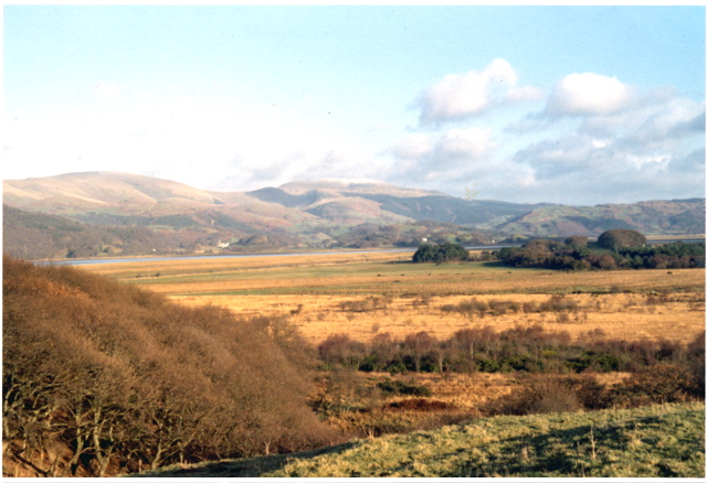
Looking north from Ynysfach, 1974
The view shows much of the north-west part of the gridsquare, looking north from Ynysfach towards Covert Coch, across drained land. Upper reaches of the Dyfi estuary are visible in the distance.
 Map © Crown Copyright")
TIP: Click the map for more Large scale mapping
- Grid Square
- SN6795, 21 images (more nearby 🔍)
- Photographer
- David Rowlands (more nearby)
- Date Taken
- Friday, 1 February, 1974 (more nearby)
- Submitted
- Monday, 26 February, 2007
- Subject Location
-
OSGB36:
 SN 672 958 [100m precision]
WGS84: 52:32.6294N 3:57.5304W - Camera Location
-
OSGB36: SN 670 950
- View Direction
- North-northeast (about 22 degrees)