J3674 : Connsbrook Avenue Congregational church, Belfast
taken 11 years ago, 3 km from Belfast, Co Antrim, Northern Ireland
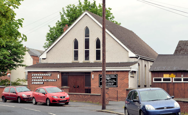
Connsbrook Avenue Congregational church, Belfast
The modern building at the Holywood Road end of Connsbrook Avenue. The church has been on the site since 1899 when it might have been known as the Connsbrook Avenue Independent Church.
![Creative Commons Licence [Some Rights Reserved]](https://s1.geograph.org.uk/img/somerights20.gif)
|
· Find out How to reuse this image ·
Share:
|
|||||
| Start a discussion on J3674 | Suggest an update to this image | Contact the contributor | |||
Loading map... (JavaScript required)
- Grid Square
- J3674, 822 images (more nearby
 )
)
- Photographer
- Albert Bridge (find more nearby)
- Date Taken
- Monday, 3 June, 2013 (more nearby)
- Submitted
- Monday, 3 June, 2013
- Geographical Context
- Place (from Tags)
- Subject Location
-
Irish:
 J 367 743 [100m precision]
WGS84: 54:35.9547N 5:53.1244W - Camera Location
-
Irish: J 367 744
- View Direction
- Southwest (about 225 degrees)
Other Tags
Image classification(about):
Geograph
This page has been viewed about 133 times.
View this location:
KML (Google Earth) ·
Google Maps ·
Bing Maps ·
Geograph Coverage Map ·
More Links for this image
·
Bing Maps ·
Geograph Coverage Map ·
More Links for this image