2007
NS6226 : Confluence of R. Ayr and Greenock Water
taken 17 years ago, near to Garpel, East Ayrshire, Scotland
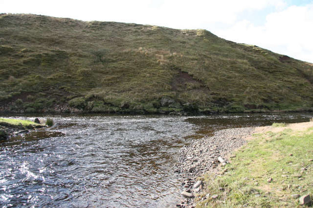
Confluence of R. Ayr and Greenock Water
The R.Ayr is flowing from left to right across the photograph. In the background is the slope up to the river terrace which is close to the left bank of the R.Ayr for 1km downstream. To the right of the confluence is the fine sand and rounded gravel deposits which together make up the present floodplain. This is covered in improved grassland and provides grazing for sheep and later in the year,for beef cattle.
 Map © Crown Copyright")
TIP: Click the map for more Large scale mapping
- Grid Square
- NS6226, 7 images (more nearby 🔍)
- Photographer
- Bob Forrest (more nearby)
- Date Taken
- Monday, 26 February, 2007 (more nearby)
- Submitted
- Saturday, 3 March, 2007
- Subject Location
-
OSGB36:
 NS 627 269 [100m precision]
WGS84: 55:31.0016N 4:10.4887W - Camera Location
-
OSGB36: NS 628 270
- View Direction
- Southwest (about 225 degrees)