J3975 : No 303 Belmont Road, Belfast
taken 11 years ago, 3 km from Dundonald, Co Down, Northern Ireland
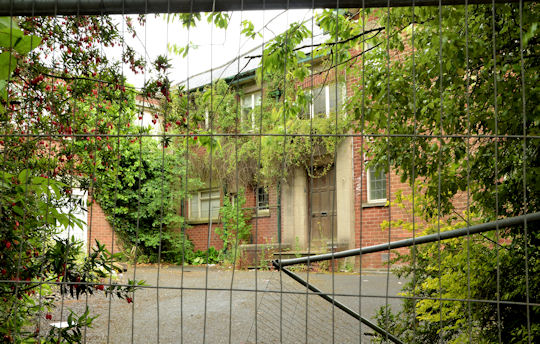
No 303 Belmont Road, Belfast
See J3975 : No 305 Belmont Road, Belfast (October 2011). No 303 occupies the adjoining site, close to the corner of Tweskard Park and is now offered for sale after a corporate insolvency. The agents brochure includes the following: Full planning permission has been granted for the demolition of the existing dwelling and redevelopment consisting of 3 No. 2½ storey terraced dwellings, 3 No. apartments, associated landscaping and car parking. This permission was granted on 7 September 2009 (Planning ref: Z/2008/1104/F). This photograph appears as a matter of record only. I have no connection with any of the parties involved in the sale.
The Belmont Road, Belfast
The Belmont Road runs from the Holywood Road, at Gelstons Corner, through suburban east Belfast, to Craigantlet hill just outside the built-up area.
Nos 303 & 305 Belmont Road, Belfast
The site of two large detached suburban houses for which there is an application for planning permission (Z/2013/1290/F November 2013) to redevelop the sites by building seven detached houses. The photographs submitted by me appear as a neutral matter of geographical and historical record only. I have no connection with any of the parties involved in the proposed development and do not express any opinion for or against the application.
![Creative Commons Licence [Some Rights Reserved]](https://s1.geograph.org.uk/img/somerights20.gif)
|
· Find out How to reuse this image ·
Share:
|
|||||
| Start a discussion on J3975 | Suggest an update to this image | Contact the contributor | |||
Loading map... (JavaScript required)
- Grid Square
- J3975, 81 images (more nearby
 )
)
- Photographer
- Albert Bridge (find more nearby)
- Date Taken
- Monday, 24 June, 2013 (more nearby)
- Submitted
- Monday, 24 June, 2013
- Geographical Context
- Place (from Tags)
- Subject Location
-
Irish:
 J 391 752 [100m precision]
WGS84: 54:36.3509N 5:50.8285W - Camera Location
-
Irish: J 391 752
- View Direction
- East-southeast (about 112 degrees)
Other Tags
Image classification(about):
Geograph
This page has been viewed about 208 times.
View this location:
KML (Google Earth) ·
Google Maps ·
Bing Maps ·
Geograph Coverage Map ·
More Links for this image
·
Bing Maps ·
Geograph Coverage Map ·
More Links for this image