2007
NS6527 : Watershed
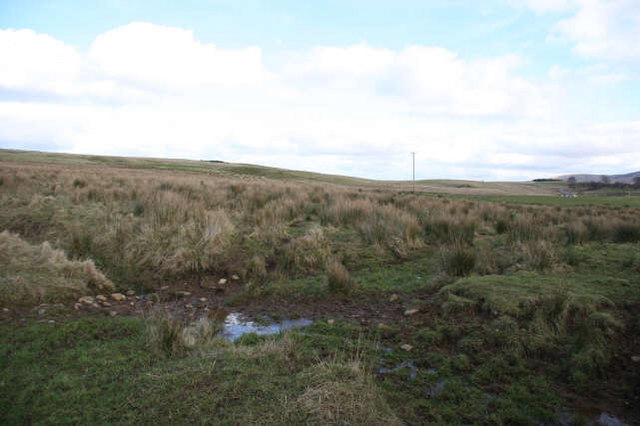
taken 17 years ago, near to Nether Wellwood, East Ayrshire, Scotland
Watershed
The sloping land following the line of the B743 to its junction with the A70 to Muirkirk, is part of a ridge separating the drainage to the R.Ayr from that to the Greenock Water. The ruin of West Dalfram can just be seen to the middle right of the photograph. The wet heavy nature of the ground here can also be seen.
 Map © Crown Copyright")
TIP: Click the map for more Large scale mapping
- Grid Square
- NS6527, 6 images (more nearby 🔍)
- Photographer
- Bob Forrest (more nearby)
- Date Taken
- Monday, 26 February, 2007 (more nearby)
- Submitted
- Sunday, 4 March, 2007
- Subject Location
-
OSGB36:
 NS 652 270 [100m precision]
WGS84: 55:31.0860N 4:8.1457W - Camera Location
-
OSGB36: NS 647 270
- View Direction
- EAST (about 90 degrees)