D0802 : The Sourhill roundabouts, Ballymena/Galgorm
taken 11 years ago, near to Galgorm, Co Antrim, Northern Ireland
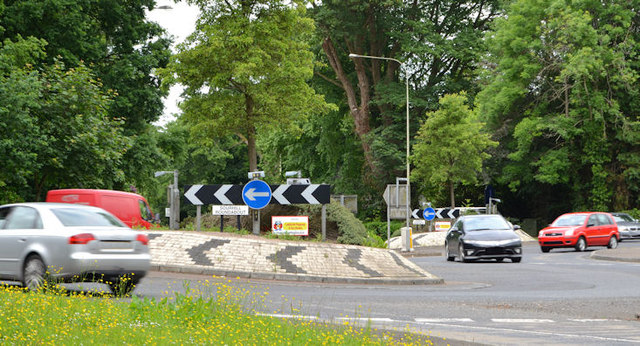
The Sourhill roundabouts, Ballymena/Galgorm
Two small roundabouts at what, without them, would be a busy and potentially dangerous meeting of three roads. The main Ballymena Galgorm/Ahoghill road is at bottom right. The Old Galgorm Road at lower middle right and the Sourhill Road just out of picture to the left. County Hall D0802 : County Hall is behind the trees on the left.
![Creative Commons Licence [Some Rights Reserved]](https://s1.geograph.org.uk/img/somerights20.gif)
|
· Find out How to reuse this image ·
Share:
|
|||||
| Start a discussion on D0802 | Suggest an update to this image | Contact the contributor | |||
Loading map... (JavaScript required)
- Grid Square
- D0802, 10 images (more nearby
 )
)
- Photographer
- Albert Bridge (find more nearby)
- Date Taken
- Monday, 1 July, 2013 (more nearby)
- Submitted
- Monday, 1 July, 2013
- Geographical Context
- Place (from Tags)
- Subject Location
-
Irish:
 D 086 024 [100m precision]
WGS84: 54:51.4964N 6:18.5418W - Camera Location
-
Irish: D 086 024
- View Direction
- West-northwest (about 292 degrees)
Other Tags
Image classification(about):
Geograph (Second Visitor for D0802)
· First in 5 Years (TPoint) (about)
This page has been viewed about 218 times.
View this location:
KML (Google Earth) ·
Google Maps ·
Bing Maps ·
Geograph Coverage Map ·
More Links for this image
·
Bing Maps ·
Geograph Coverage Map ·
More Links for this image