2013
NG7622 : Sgurr na Coinnich from Beinn na Caillich
taken 11 years ago, 3 km from Kylerhea/Caol Reatha, Isle of Skye, Scotland
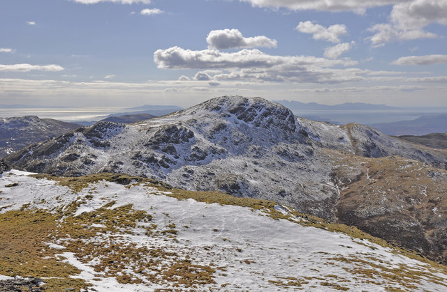
Sgurr na Coinnich from Beinn na Caillich
The isles of Eigg and Rum in the background.
 Map © Crown Copyright")
TIP: Click the map for more Large scale mapping
- Grid Square
- NG7622, 8 images (more nearby 🔍)
- Photographer
- Iain A Robertson (more nearby)
- Date Taken
- Saturday, 30 March, 2013 (more nearby)
- Submitted
- Wednesday, 10 July, 2013
- Subject Location
-
OSGB36:
 NG 7639 2230 [10m precision]
WGS84: 57:14.1964N 5:42.4257W - Camera Location
-
OSGB36: NG 7709 2288
- View Direction
- Southwest (about 225 degrees)