D0644 : Towards Carrick-a-Rede
taken 11 years ago, near to Ballintoy, Co Antrim, Northern Ireland
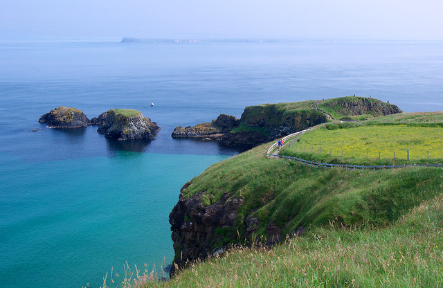
Towards Carrick-a-Rede
The path down towards Carrick-a-Rede rope bridge and island (on the right). The two smaller islands on the left are inaccessible. Rathlin Island is beyond.
![Creative Commons Licence [Some Rights Reserved]](https://s1.geograph.org.uk/img/somerights20.gif)
|
· Find out How to reuse this image ·
Share:
|
|||||
| Start a discussion on D0644 | Suggest an update to this image | Contact the contributor | |||
Loading map... (JavaScript required)
- Grid Square
- D0644, 98 images (more nearby
 )
)
- Photographer
- Rossographer (find more nearby)
- Date Taken
- Friday, 12 July, 2013 (more nearby)
- Submitted
- Thursday, 18 July, 2013
- Geographical Context
- Place (from Tags)
- Subject Location
-
Irish:
 D 061 449 [100m precision]
WGS84: 55:14.3974N 6:19.9490W - Camera Location
-
Irish: D 060 448
- View Direction
- Northeast (about 45 degrees)
Other Tags
Image classification(about):
Geograph
This page has been viewed about 34 times.
View this location:
KML (Google Earth) ·
Google Maps ·
Bing Maps ·
Geograph Coverage Map ·
More Links for this image
·
Bing Maps ·
Geograph Coverage Map ·
More Links for this image