SK8440 : Sewstern Lane
taken 11 years ago, near to Allington, Lincolnshire, England
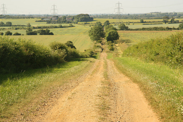
Sewstern Lane, or 'The Drift', used as part of the Viking Way long distance path, can be traced from Long Bennington for about 20 miles south where it joins Ermine Street just north of Stamford. The southern part of the lane (south of its crossing of the Roman road Margary no. RR58a at SK860298) corresponds to the Roman road Margary no. RR580. According to W.G. Hoskins (1955, The Making of the English Lanscape) and Link
the track has been used from pre-Roman times, and was one of the main north-south routes before being superseded in the seventeenth century by the Great North Road to the east (current A1 between Long Bennington and Stamford). But the lane continued to be used as a major cattle-droving route (hence 'Drift' = the driving of cattle or sheep), as it would have avoided the hard surface, lack of grazing, traffic and expensive tolls on the Great North Road.
 Map © Crown Copyright")
- Grid Square
- SK8440, 22 images (more nearby 🔍)
- Photographer
- Richard Croft (more nearby)
- Date Taken
- Tuesday, 9 July, 2013 (more nearby)
- Submitted
- Friday, 19 July, 2013
- Subject Location
-
OSGB36:
 SK 8411 4049 [10m precision]
WGS84: 52:57.3121N 0:44.9666W - Camera Location
-
OSGB36: SK 8413 4000
- View Direction
- NORTH (about 0 degrees)