J4772 : View from Scrabo
taken 11 years ago, near to Newtownards, Co Down, Northern Ireland
This is 1 of 2 images, with title View from Scrabo in this square
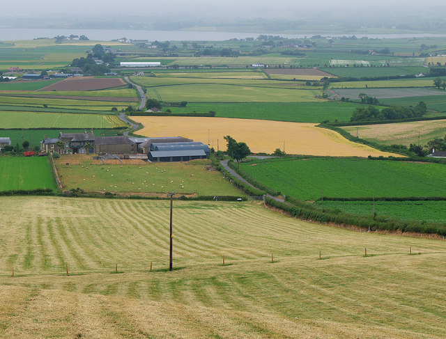
View from Scrabo
A view from the path leading up towards Scrabo Tower near Newtownards. Fields falling steeply away from Scrabo Tower are in the foreground, leading to a farm on the Scrabo Road. To the right is the Moat Road running down towards the main Newtownards to Comber road. A small section of Stangford Lough near Comber is behind. Compare with J4772 : View from Scrabo taken 5 months earlier.
![Creative Commons Licence [Some Rights Reserved]](https://s1.geograph.org.uk/img/somerights20.gif)
|
· Find out How to reuse this image ·
Share:
|
|||||
| Start a discussion on J4772 | Suggest an update to this image | Contact the contributor | |||
Loading map... (JavaScript required)
- Grid Square
- J4772, 210 images (more nearby
 )
)
- Photographer
- Rossographer (find more nearby)
- Date Taken
- Sunday, 21 July, 2013 (more nearby)
- Submitted
- Tuesday, 23 July, 2013
- Geographical Context
- Place (from Tags)
- Subject Location
-
Irish:
 J 477 720 [100m precision]
WGS84: 54:34.5138N 5:42.9632W - Camera Location
-
Irish: J 476 723
- View Direction
- South-southeast (about 157 degrees)
Other Tags
Image classification(about):
Geograph
This page has been viewed about 71 times.
View this location:
KML (Google Earth) ·
Google Maps ·
Bing Maps ·
Geograph Coverage Map ·
More Links for this image
·
Bing Maps ·
Geograph Coverage Map ·
More Links for this image