M2300 : Clints and grikes at Poulnabrone
taken 11 years ago, 5 km WNW of Carran, Co Clare, Ireland
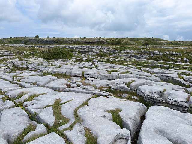
Clints and grikes at Poulnabrone
Limestone pavement dissected by fissures.
![Creative Commons Licence [Some Rights Reserved]](https://s1.geograph.org.uk/img/somerights20.gif)
|
· Find out How to reuse this image ·
Share:
|
|||||
| Start a discussion on M2300 | Suggest an update to this image | Contact the contributor | |||
Loading map... (JavaScript required)
- Grid Square
- M2300, 100 images (more nearby
 )
)
- Photographer
- Oliver Dixon (find more nearby)
- Date Taken
- Tuesday, 16 July, 2013 (more nearby)
- Submitted
- Tuesday, 23 July, 2013
- Geographical Context
- Subject Location
-
Irish:
 M 235 004 [100m precision]
WGS84: 53:2.9723N 9:8.4171W - Camera Location
-
Irish: M 236 003
- View Direction
- North-northwest (about 337 degrees)
Other Tags
Image classification(about):
Geograph
This page has been viewed about 57 times.
View this location:
KML (Google Earth) ·
Google Maps ·
Bing Maps ·
Geograph Coverage Map ·
More Links for this image
·
Bing Maps ·
Geograph Coverage Map ·
More Links for this image