V9434 : Barnancleeve Pass
taken 11 years ago, 4 km NNE of Skull, Co Cork, Ireland
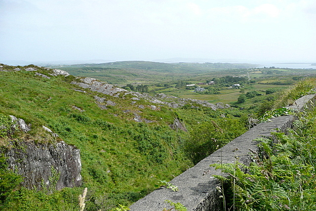
Barnancleeve Pass
Looking south from just south of the pass, as the view opens out towards Skull Harbour. There are former copper mines in this area.
![Creative Commons Licence [Some Rights Reserved]](https://s1.geograph.org.uk/img/somerights20.gif)
|
· Find out How to reuse this image ·
Share:
|
|||||
| Start a discussion on V9434 | Suggest an update to this image | Contact the contributor | |||
Loading map... (JavaScript required)
- Grid Square
- V9434, 3 images (more nearby
 )
)
- Photographer
- Graham Horn (find more nearby)
- Date Taken
- Monday, 1 July, 2013 (more nearby)
- Submitted
- Tuesday, 23 July, 2013
- Geographical Context
- Subject Location
-
Irish:
 V 942 348 [100m precision]
WGS84: 51:33.3873N 9:31.5721W - Camera Location
-
Irish: V 941 349
- View Direction
- Southeast (about 135 degrees)
Image classification(about):
Geograph (Second Visitor for V9434)
· First in 5 Years (TPoint) (about)
This page has been viewed about 133 times.
View this location:
KML (Google Earth) ·
Google Maps ·
Bing Maps ·
Geograph Coverage Map ·
More Links for this image
·
Bing Maps ·
Geograph Coverage Map ·
More Links for this image