J3973 : No 517 Upper Newtownards Road, Belfast (2013-1)
taken 11 years ago, 3 km from Dundonald, Co Down, Northern Ireland
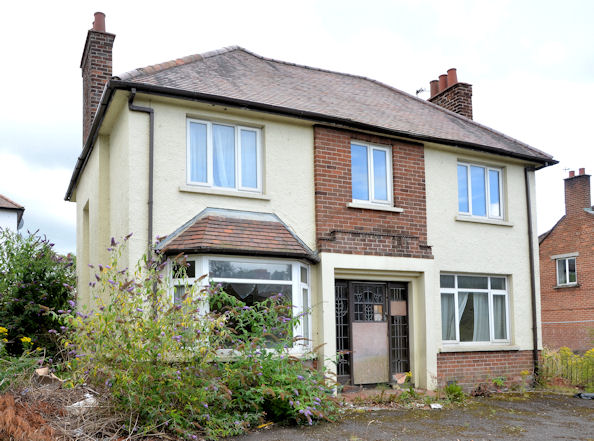
No 517 Upper Newtownards Road, Belfast (2013-1)
No 515 has been demolished but 517 remains standing.
Nos 515 & 517 Upper Newtownards Road, Belfast
Two vacant houses (probably awaiting redevelopment) at 515 & 517 Upper Newtownards Road.
![Creative Commons Licence [Some Rights Reserved]](https://s1.geograph.org.uk/img/somerights20.gif)
|
· Find out How to reuse this image ·
Share:
|
|||||
| Start a discussion on J3973 | Suggest an update to this image | Contact the contributor | |||
Loading map... (JavaScript required)
- Grid Square
- J3973, 94 images (more nearby
 )
)
- Photographer
- Albert Bridge (find more nearby)
- Date Taken
- Monday, 12 August, 2013 (more nearby)
- Submitted
- Tuesday, 13 August, 2013
- Geographical Context
- Place (from Tags)
- Subject Location
-
Irish:
 J 392 739 [100m precision]
WGS84: 54:35.6547N 5:50.7910W - Camera Location
-
Irish: J 392 739
- View Direction
- Southwest (about 225 degrees)
Other Tags
Image classification(about):
Geograph
This page has been viewed about 90 times.
View this location:
KML (Google Earth) ·
Google Maps ·
Bing Maps ·
Geograph Coverage Map ·
More Links for this image
·
Bing Maps ·
Geograph Coverage Map ·
More Links for this image