1997
TQ0188 : River Misbourne Isle of Wight Farm
taken 27 years ago, near to Gerrards Cross, Buckinghamshire, England
River Misbourne Isle of Wight Farm
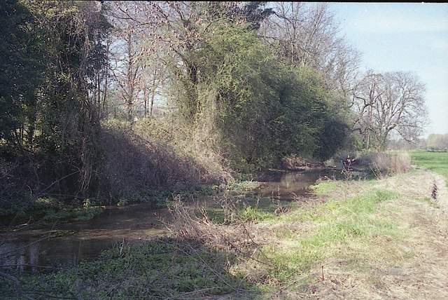
This part of the River Misbourne was experiencing extreme low flows when this photograph was taken in the spring of 1997. The river here dried out for several months later that year, becoming dry from source downstream to the discharge point of Gerrards Cross sewage treatment works.
Native white-clawed crayfish (Austropotamobius pallipes) were regularly seen in the Misbourne here until the channel dried in 1997. A short reach of the Misbourne here was one of the last places they could still be found across the home counties - from where they are now almost certainly locally extinct.
The invasive North American signal crayfish (Pacifastacus leniusculus) is now abundant within the Misbourne, as elsewhere across much of southern England. The spread of this species has eradicated populations of native crayfish as they carry a lethal fungus and outcompete the smaller native species. Although signals first became established within Shardeloes Lake and the upper Misbourne during the early 1990s, the native crayfish population downstream was protected by the isolation caused by a lengthy intermediate section of river that remained perennially dry during this period.
 Map © Crown Copyright")
TIP: Click the map for more Large scale mapping
- Grid Square
- TQ0188, 57 images (more nearby 🔍)
- Photographer
- David Leeming (more nearby)
- Date Taken
- Monday, 7 April, 1997 (more nearby)
- Submitted
- Friday, 13 September, 2013
- Subject Location
-
OSGB36:
 TQ 0138 8824 [10m precision]
WGS84: 51:35.0345N 0:32.2905W - Camera Location
-
OSGB36: TQ 0140 8822
- View Direction
- Northwest (about 315 degrees)