C3321 : Inch Lake
taken 11 years ago, near to Speenoge, Co Donegal, Ireland
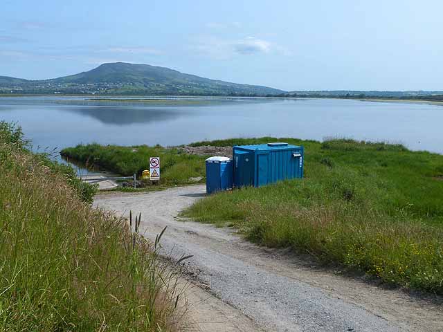
Inch Lake
Inch Lake is a freshwater lake only a very short height above sea level which was formed by the construction of two causeways across the channel separating Inch Island from the mainland. Here seen from the southern end of the western causeway. The hills of Inishowen in the distance.
![Creative Commons Licence [Some Rights Reserved]](https://s1.geograph.org.uk/img/somerights20.gif)
|
· Find out How to reuse this image ·
Share:
|
|||||
| Start a discussion on C3321 | Suggest an update to this image | Contact the contributor | |||
Loading map... (JavaScript required)
- Grid Square
- C3321, 5 images (more nearby
 )
)
- Photographer
- Oliver Dixon (find more nearby)
- Date Taken
- Friday, 12 July, 2013 (more nearby)
- Submitted
- Wednesday, 25 September, 2013
- Geographical Context
- Subject Location
-
Irish:
 C 336 219 [100m precision]
WGS84: 55:2.6282N 7:28.4431W - Camera Location
-
Irish: C 335 219
- View Direction
- East-northeast (about 67 degrees)
Other Tags
Image classification(about):
Geograph
This page has been viewed about 34 times.
View this location:
KML (Google Earth) ·
Google Maps ·
Bing Maps ·
Geograph Coverage Map ·
More Links for this image
·
Bing Maps ·
Geograph Coverage Map ·
More Links for this image