1994
SK5064 : Pleasley St. Michaels Church
taken 30 years ago, near to Pleasley, Derbyshire, England
This is 1 of 29 images, with title starting with Pleasley in this square
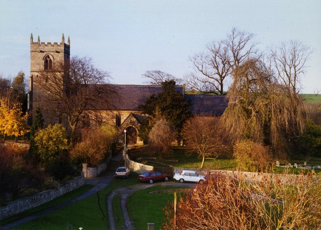
Pleasley St. Michaels Church
The church is believed to originate from the 12th century but was greatly restored in the 19th century. It is situated close to the River Meden which marks the county boundary and also the boundary of the ancient Sherwood Forest.
 Map © Crown Copyright")
TIP: Click the map for more Large scale mapping
- Grid Square
- SK5064, 134 images (more nearby 🔍)
- Photographer
- Brian Downing (more nearby)
- Date Taken
- October 1994 (more nearby)
- Submitted
- Friday, 16 March, 2007
- Subject Location
-
OSGB36:
 SK 504 645 [100m precision]
WGS84: 53:10.5567N 1:14.8082W - Camera Location
-
OSGB36: SK 504 644
- View Direction
- NORTH (about 0 degrees)