2013
NG3898 : Western end of the Galtachan
taken 11 years ago, near to Galta Mòr [other Features], Na h-Eileanan an Iar, Great Britain
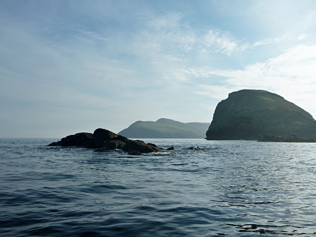
Western end of the Galtachan
Galta Mòr and a few tidal skerries to the west. A theory for the etymology is that it derives from a Norse word that is the root of 'gable' in English.
There is another tidal rock further to the west, Damhag, but it was still underwater at this stage of the tide.
There is another tidal rock further to the west, Damhag, but it was still underwater at this stage of the tide.
 Map © Crown Copyright")
TIP: Click the map for more Large scale mapping
- Grid Square
- NG3898 (more nearby 🔍)
- Photographer
- Toby Speight (more nearby)
- Date Taken
- Sunday, 29 September, 2013 (more nearby)
- Submitted
- Wednesday, 2 October, 2013
- Subject Location
-
OSGB36:
 NG 3879 9843 [10m precision]
WGS84: 57:53.9131N 6:24.6056W - Camera Location
-
OSGB36: NG 38677 98448
- View Direction
- EAST (about 90 degrees)