2007
TF4721 : Bridge Road, Sutton Bridge
taken 17 years ago, near to Sutton Bridge, Lincolnshire, England
This is 1 of 3 images, with title Bridge Road, Sutton Bridge in this square
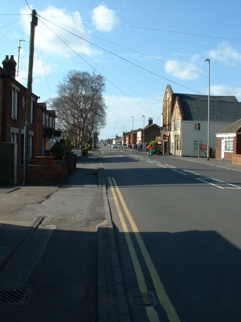
Bridge Road, Sutton Bridge
The main street through the village. It was the main A17 until the Washway bypass was built in the 1980s. The village dates mostly from the 1830s when a new cut was built to drain Cross Keys Marsh, and was bridged at this point.
 Map © Crown Copyright")
TIP: Click the map for more Large scale mapping
- Grid Square
- TF4721, 41 images (more nearby 🔍)
- Photographer
- David Prestidge (more nearby)
- Date Taken
- Saturday, 17 March, 2007 (more nearby)
- Submitted
- Saturday, 17 March, 2007
- Subject Location
-
OSGB36:
 TF 475 213 [100m precision]
WGS84: 52:46.1817N 0:11.0936E - Camera Location
-
OSGB36: TF 477 212
- View Direction
- West-northwest (about 292 degrees)