J3479 : Gray's Lane, Belfast (1)
taken 10 years ago, 3 km from Newtownabbey, Co Antrim, Northern Ireland
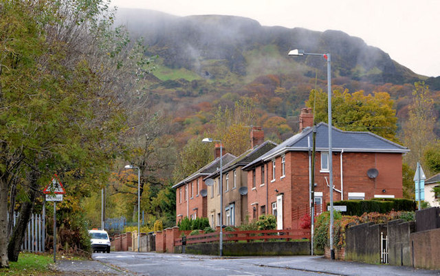
Gray's Lane, Belfast (1)
This view is towards the Antrim Road from opposite Graymount Drive.
Gray's Lane, Belfast
Grays Lane was built circa 1908/10. It runs, steely uphill, through Fortwilliam golf course, from the Shore Road to the Antrim Road. The name seems to come from Captain George Gray, a Victorian gentleman who owned a nearby house called Graymount".
![Creative Commons Licence [Some Rights Reserved]](https://s1.geograph.org.uk/img/somerights20.gif)
|
· Find out How to reuse this image ·
Share:
|
|||||
| Start a discussion on J3479 | Suggest an update to this image | Contact the contributor | |||
Loading map... (JavaScript required)
- Grid Square
- J3479, 49 images (more nearby
 )
)
- Photographer
- Albert Bridge (find more nearby)
- Date Taken
- Monday, 11 November, 2013 (more nearby)
- Submitted
- Monday, 11 November, 2013
- Geographical Context
- Place (from Tags)
- Subject Location
-
Irish:
 J 340 793 [100m precision]
WGS84: 54:38.6421N 5:55.4574W - Camera Location
-
Irish: J 341 792
- View Direction
- West-northwest (about 292 degrees)
Other Tags
Image classification(about):
Geograph
This page has been viewed about 228 times.
View this location:
KML (Google Earth) ·
Google Maps ·
Bing Maps ·
Geograph Coverage Map ·
More Links for this image
·
Bing Maps ·
Geograph Coverage Map ·
More Links for this image