2013
SO7901 : Toposcope on Coaley Peak
taken 10 years ago, near to Nympsfield, Gloucestershire, England
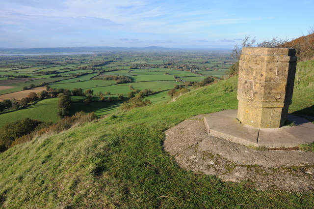
Toposcope on Coaley Peak
This toposcope on Coaley Peak stands on a wonderful viewpoint with an open vista over the Vale of Berkeley to the Forest of Dean with the mountains of south Wales beyond. In the view the Severn can be seen on the left along with May Hill in the centre and the southern end of the Malvern Hills on the right. On this very clear day Clee Hill in shropshire was visible to the right of May Hill.
 Map © Crown Copyright")
TIP: Click the map for more Large scale mapping
- Grid Square
- SO7901, 107 images (more nearby 🔍)
- Photographer
- Philip Halling (more nearby)
- Date Taken
- Sunday, 10 November, 2013 (more nearby)
- Submitted
- Thursday, 14 November, 2013
- Subject Location
-
OSGB36:
 SO 7931 0103 [10m precision]
WGS84: 51:42.4573N 2:18.0495W - Camera Location
-
OSGB36: SO 7932 0102
- View Direction
- North-northwest (about 337 degrees)