2001
SJ2023 : Site of former Llansilin Road station
taken 23 years ago, near to Pen-y-Bont Llanerch Emrys, Powys, Wales
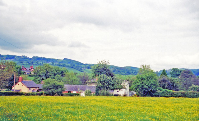
Site of former Llansilin Road station
View NE towards the bridge over the Afon Tanat. The station was about 3 miles from Llansilin and was on the ex-Cambrian/GWR Tanat Valley Light Railway (Oswestry) - Blodwell Junction - Llangynog, closed 15/1/51, goods continuing Llanrhaiadr - Blodwell Junction until 6/1/64.
 Map © Crown Copyright")
TIP: Click the map for more Large scale mapping
- Grid Square
- SJ2023, 6 images (more nearby 🔍)
- Photographer
- Ben Brooksbank (more nearby)
- Date Taken
- Saturday, 26 May, 2001 (more nearby)
- Submitted
- Tuesday, 26 November, 2013
- Subject Location
-
OSGB36:
 SJ 209 233 [100m precision]
WGS84: 52:48.1295N 3:10.4570W - Camera Location
-
OSGB36: SJ 209 233
- View Direction
- Northeast (about 45 degrees)