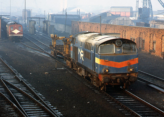
J3574 : 102 "Falcon" at CSD - 1989
taken 34 years ago, near to Belfast, Co Antrim, Northern Ireland
Situated on the County Down side of the River Lagan, Queens Quay station opened in 1848 as the Belfast terminus for the Belfast & County Down Railway (BCDR). The Belfast Holywood & Bangor Railway built a separate terminus in 1865 and this was combined with the BCDR buildings when the two companies merged in 1884. However, the original structures were largely demolished when Queens Quay station was extensively rebuilt in 1910-14.
The BCDR was acquired by the Ulster Transport Authority (UTA) in 1948 and Queens Quay suffered grievously following closure of the BCDR main line to Newcastle in 1950. In the early 1950s, the UTA removed the overall roof while track to Platform 5 and the surviving locomotive release roads were lifted in the early 1960s. The former BCDR freight sheds were also abandoned.
Formed in 1967, Northern Ireland Railways (NIR) closed Queens Quay station on 10 April 1976, services transferring to the new Belfast Central Station. By this time, Queens Quay was a pale shadow of its former glory with much internal damage due to terrorist attacks. Although the station was later demolished, the former yards and servicing facilities became Central Services Depot (CSD), being used by NIR for stock storage and railcar maintenance. CSD closed in November 1994 on completion of the cross-harbour rail & road links and the entire Queens Quay site is now buried under the M3 motorway.
For the purpose of this Shared Description, Queens Quay covers the area out to Ballymacarrett Junction. For photographs of surviving structures on the BCDR line to Newcastle (and branches), see: Link. For photographs on the line between Ballymacarrett Junction and Bangor, see: Link
![Creative Commons Licence [Some Rights Reserved]](https://s1.geograph.org.uk/img/somerights20.gif)
|
· Find out How to reuse this image ·
Share:
|
|||||
| Start a discussion on J3574 | Suggest an update to this image | Contact the contributor | |||
- Grid Square
- J3574, 516 images (more nearby
 )
)
- Photographer
- The Carlisle Kid (find more nearby)
- Date Taken
- Sunday, 3 December, 1989 (more nearby)
- Submitted
- Friday, 27 December, 2013
- Geographical Context
- Subject Location
-
Irish:
 J 352 746 [100m precision]
WGS84: 54:36.1127N 5:54.4626W - Camera Location
-
Irish: J 353 746
- View Direction
- West-northwest (about 292 degrees)