N1556 : The N55 at the Inny River Bridge at Ballymahon
taken 11 years ago, near to Ballymahon, Co Longford, Ireland
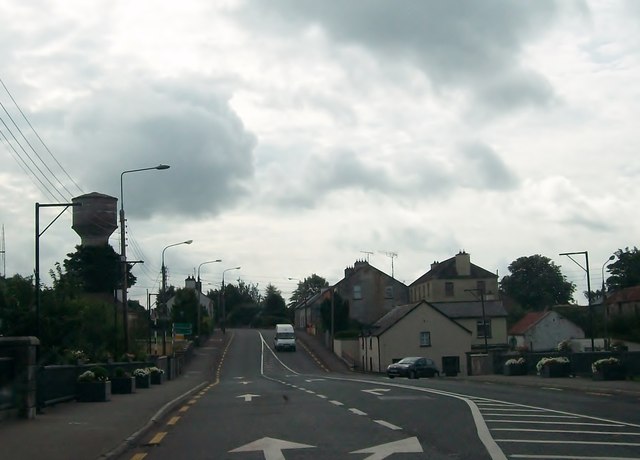
The N55 at the Inny River Bridge at Ballymahon
The town's water tower is on the left, just south of the river. The scaffolds are for hanging flower baskets. Travellers on the N55 south of the town move to the outside lane here.
![Creative Commons Licence [Some Rights Reserved]](https://s1.geograph.org.uk/img/somerights20.gif)
|
· Find out How to reuse this image ·
Share:
|
|||||
| Start a discussion on N1556 | Suggest an update to this image | Contact the contributor | |||
Loading map... (JavaScript required)
- Grid Square
- N1556, 7 images (more nearby
 )
)
- Photographer
- Eric Jones (find more nearby)
- Date Taken
- Tuesday, 20 August, 2013 (more nearby)
- Submitted
- Monday, 30 December, 2013
- Geographical Context
- Subject Location
-
Irish:
 N 158 568 [100m precision]
WGS84: 53:33.7127N 7:45.7290W - Camera Location
-
Irish: N 157 569
- View Direction
- Southeast (about 135 degrees)
Image classification(about):
Geograph (Third Visitor for N1556)
This page has been viewed about 47 times.
View this location:
KML (Google Earth) ·
Google Maps ·
Bing Maps ·
Geograph Coverage Map ·
More Links for this image
·
Bing Maps ·
Geograph Coverage Map ·
More Links for this image