2013
SW7140 : Panoramic sign near the summit of Carn Marth
taken 11 years ago, near to Lanner, Cornwall, England
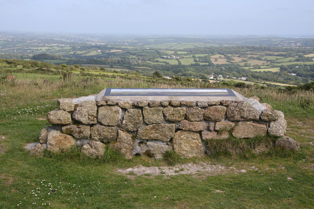
Panoramic sign near the summit of Carn Marth
Actually slightly below the highest point, next to the flooded quarry. From here there is a 360 degree view taking in both the north and south coasts of Cornwall, east to the clay pit waste heaps at St. Austell and west over Carn Brea above Redruth. The sign is a stitched together panoramic photograph with various locations and landmarks identified.
 Map © Crown Copyright")
TIP: Click the map for more Large scale mapping
- Grid Square
- SW7140, 36 images (more nearby 🔍)
- Photographer
- Graham Loveland (more nearby)
- Date Taken
- Thursday, 4 July, 2013 (more nearby)
- Submitted
- Friday, 14 February, 2014
- Subject Location
-
OSGB36:
 SW 7170 4081 [10m precision]
WGS84: 50:13.3877N 5:12.1173W - Camera Location
-
OSGB36: SW 7169 4082
- View Direction
- South-southeast (about 157 degrees)