2014
TL1097 : Water Newton Lock
taken 10 years ago, near to Water Newton, Cambridgeshire, England
This is 1 of 5 images, with title Water Newton Lock in this square
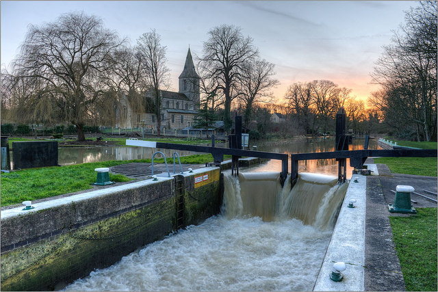
Water Newton Lock
Water Newton lock and St Remigius' church. This small village is situated beside the Nene to the west of Peterborough. Partly within the parish is the site of the Roman town of Durobivae sited where Ermine Street crossed the Nene. It started as a settlement serving a fort, but grew into an important regional capital. Town walls were built in the second century and the town was intensively occupied and often re-built.
 Map © Crown Copyright")
TIP: Click the map for more Large scale mapping
- Grid Square
- TL1097, 105 images (more nearby 🔍)
- Photographer
- Julian Dowse (more nearby)
- Date Taken
- Sunday, 16 February, 2014 (more nearby)
- Submitted
- Tuesday, 18 February, 2014
- Subject Location
-
OSGB36:
 TL 109 973 [100m precision]
WGS84: 52:33.7665N 0:21.9063W - Camera Location
-
OSGB36: TL 109 973
- View Direction
- Southwest (about 225 degrees)