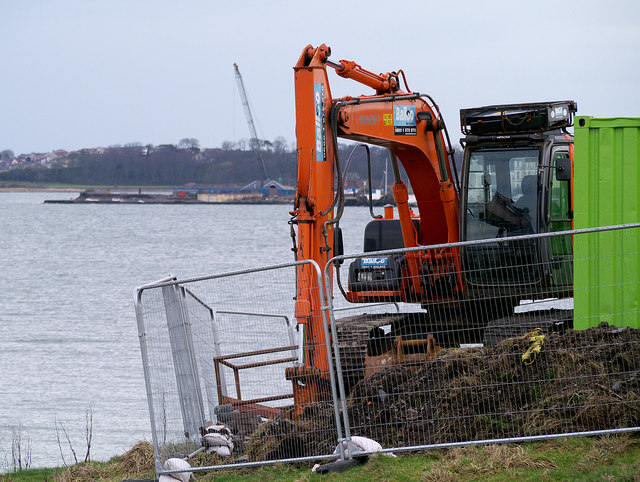
J4982 : Pumping station upgrade, Wilson's Point, Bangor
taken 10 years ago, near to Bangor, Co Down, Northern Ireland

Images of the sewerage improvement scheme around Bangor, begun in early 2014. The official text below is from Link
:
"An essential programme of improvement work is currently underway to upgrade the sewerage infrastructure and key pumping stations in the Bangor area.
The first phase of NI Water’s essential improvement programme represents an investment in the region of £3.1 million and will involve upgrade work at Luke’s Point and the construction of a new Pumping Station at Bangor Marina to provide extra storage capacity, particularly during periods of heavy rainfall. It is anticipated that work will be complete before Summer 2014.
The project is good news for the local area and will greatly improve the water quality in Ballyholme strand and the North Down coastal waters, whilst improving the sewerage infrastructure in the North Down area. The work will also ensure that NI Water complies with Northern Ireland Environment Agency standards and will help to ensure that local beaches meet EU Directives for bathing water quality.
Subject to funding, the next phases of this programme of work will involve upgrading Castle Park Pumping Station, followed by further phases of work planned at Brompton and Stricklands Sewage Pumping Stations, and improving the sewerage infrastructure in the Carnalea and Clandeboye areas."
See also the rather nice YouTube video at Link
- Grid Square
- J4982, 142 images (more nearby
 )
)
- Photographer
- Rossographer (find more nearby)
- Date Taken
- Tuesday, 18 February, 2014 (more nearby)
- Submitted
- Thursday, 20 February, 2014
- Geographical Context
- Place (from Tags)
- Subject Location
-
Irish:
 J 497 825 [100m precision]
WGS84: 54:40.1061N 5:40.7798W - Camera Location
-
Irish:
 J 497 825
 - View Direction
- EAST (about 90 degrees)
![Creative Commons Licence [Some Rights Reserved]](https://s1.geograph.org.uk/img/somerights20.gif)
