2014
SU4981 : Flooded meadows in East Ilsley
taken 10 years ago, near to East Ilsley, West Berkshire, England
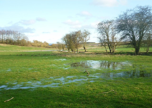
Flooded meadows in East Ilsley
Springs continue to rise in the meadows along the course of the Pang through the village. The trees mark the line of the ditch which carries the stream until it reaches open farmland.
Upper Pang - springs & sources
Following a winter of heavy rainfall, the chalk aquifer which feeds the River Pang has again become saturated, causing the groundwater to rise in many springs and pools for the second year in succession. In 2014 the westernmost sources of the Pang are rising beyond West Ilsley, and the usually dry upper sections of the Pang have flooded roads and houses in all the villages along its course.
 Map © Crown Copyright")
TIP: Click the map for more Large scale mapping
- Grid Square
- SU4981, 67 images (more nearby 🔍)
- Photographer
- Fly (more nearby)
- Date Taken
- Saturday, 22 February, 2014 (more nearby)
- Submitted
- Friday, 7 March, 2014
- Subject Location
-
OSGB36:
 SU 495 810 [100m precision]
WGS84: 51:31.5933N 1:17.2116W - Camera Location
-
OSGB36: SU 495 811
- View Direction
- East-southeast (about 112 degrees)