2014
SU4980 : River Pang at Haydon Lane, East Ilsley
taken 10 years ago, near to East Ilsley, West Berkshire, England
River Pang at Haydon Lane, East Ilsley
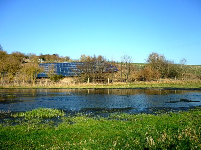
The Pang stream flowing past the sewage works. Note the solar panels on the lower hillside.
Upper Pang - springs & sources :: SU4981
Following a winter of heavy rainfall, the chalk aquifer which feeds the River Pang has again become saturated, causing the groundwater to rise in many springs and pools for the second year in succession. In 2014 the westernmost sources of the Pang are rising beyond West Ilsley, and the usually dry upper sections of the Pang have flooded roads and houses in all the villages along its course.
 Map © Crown Copyright")
TIP: Click the map for more Large scale mapping
- Grid Square
- SU4980, 128 images (more nearby 🔍)
- Photographer
- Fly (more nearby)
- Date Taken
- Sunday, 9 March, 2014 (more nearby)
- Submitted
- Sunday, 9 March, 2014
- Subject Location
-
OSGB36:
 SU 4971 8099 [10m precision]
WGS84: 51:31.5386N 1:17.0914W - Camera Location
-
OSGB36: SU 4969 8095
- View Direction
- North-northeast (about 22 degrees)