2007
SO7283 : Donkey Bridge
taken 17 years ago, near to Woodhill, Shropshire, England
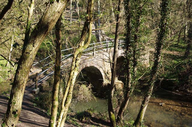
Donkey Bridge
An old packhorse bridge for transporting coal from Billingsley to the river
 Map © Crown Copyright")
TIP: Click the map for more Large scale mapping
- Grid Square
- SO7283, 5 images (more nearby 🔍)
- Photographer
- Neil Owen (more nearby)
- Date Taken
- Thursday, 5 April, 2007 (more nearby)
- Submitted
- Thursday, 5 April, 2007
- Subject Location
-
OSGB36:
 SO 726 836 [100m precision]
WGS84: 52:26.9963N 2:24.2138W - Camera Location
-
OSGB36: SO 726 835
- View Direction
- North-northwest (about 337 degrees)