J4568 : The Comber bypass - March 2014(2)
taken 10 years ago, near to Comber, Co Down, Northern Ireland
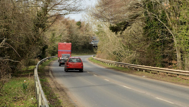
Phase 1 of the Comber bypass opened in the 60s. Phase 2 opened in 2003. Both are built on the line of the old Belfast-Donaghadee railway. It connects the Belfast road to the roads to Killyleagh/Downpatrick and Newtownards.
The Belfast and County Down Railway ran from Queens Quay station in Belfast to Castlewellan via Comber, Downpatrick and Newcastle. There were also lines from Comber to Donaghadee via Newtownards, Belfast to Bangor and branches from Ballynahinch Jct to Ballynahinch and Downpatrick to Ardglass. The lines opened between 1848 and 1892. All closed by 1950 except for Castlewellan Newcastle which survived until 1955 as part of the GNR(I) route from Belfast via Banbridge and the Bangor line which remains open but from Belfast Central.
![Creative Commons Licence [Some Rights Reserved]](https://s1.geograph.org.uk/img/somerights20.gif)
|
· Find out How to reuse this image ·
Share:
|
|||||
| Start a discussion on J4568 | Suggest an update to this image | Contact the contributor | |||
- Grid Square
- J4568, 34 images (more nearby
 )
)
- Photographer
- Albert Bridge (find more nearby)
- Date Taken
- Monday, 17 March, 2014 (more nearby)
- Submitted
- Monday, 17 March, 2014
- Geographical Context
- Place (from Tags)
- Subject Location
-
Irish:
 J 458 689 [100m precision]
WGS84: 54:32.8496N 5:44.7811W - Camera Location
-
Irish: J 459 689
- View Direction
- West-northwest (about 292 degrees)
Other Tags