J3279 : Old boundary post, Belfast
taken 10 years ago, 4 km SW of Newtownabbey, Co Antrim, Northern Ireland
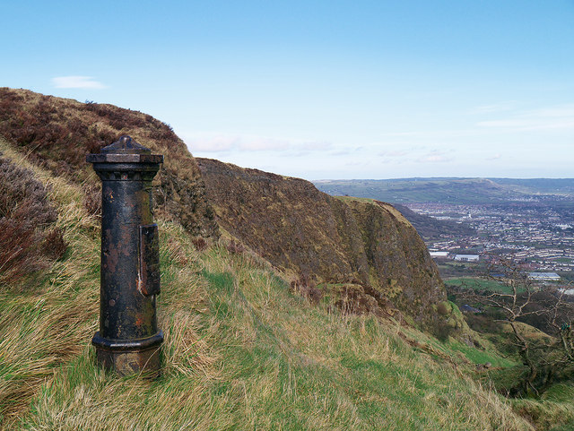
Old boundary post, Belfast
One of two old parliamentary boundary posts on McArt's Fort, Cave Hill, Belfast (the other, a little further south, is seen at J3279 : Old Boundary Post, McArt's Fort).
The inscription reads
"Parliamentary
and Municipal Boundary of
Belfast
Duncairn Division
Clifton Ward
1918".
The inscription reads
"Parliamentary
and Municipal Boundary of
Belfast
Duncairn Division
Clifton Ward
1918".
Belfast Boundary Posts
Old parliamentary and municipal boundary posts. Most appear to date from 1918. A few have been relocated from their original locations in Belfast.
![Creative Commons Licence [Some Rights Reserved]](https://s1.geograph.org.uk/img/somerights20.gif)
|
· Find out How to reuse this image ·
Share:
|
|||||
| Start a discussion on J3279 | Suggest an update to this image | Contact the contributor | |||
Loading map... (JavaScript required)
- Grid Square
- J3279, 87 images (more nearby
 )
)
- Photographer
- Rossographer (find more nearby)
- Date Taken
- Saturday, 15 March, 2014 (more nearby)
- Submitted
- Thursday, 20 March, 2014
- Geographical Context
- Place (from Tags)
- Subject Location
-
Irish:
 J 324 796 [100m precision]
WGS84: 54:38.8341N 5:56.9164W - Camera Location
-
Irish: J 324 796
- View Direction
- North-northeast (about 22 degrees)
Other Tags
Image classification(about):
Geograph
This page has been viewed about 129 times.
View this location:
KML (Google Earth) ·
Google Maps ·
Bing Maps ·
Geograph Coverage Map ·
More Links for this image
·
Bing Maps ·
Geograph Coverage Map ·
More Links for this image