J3478 : Sahara dust, Belfast - April 2014(1)
taken 10 years ago, 4 km N of Belfast, Co Antrim, Northern Ireland
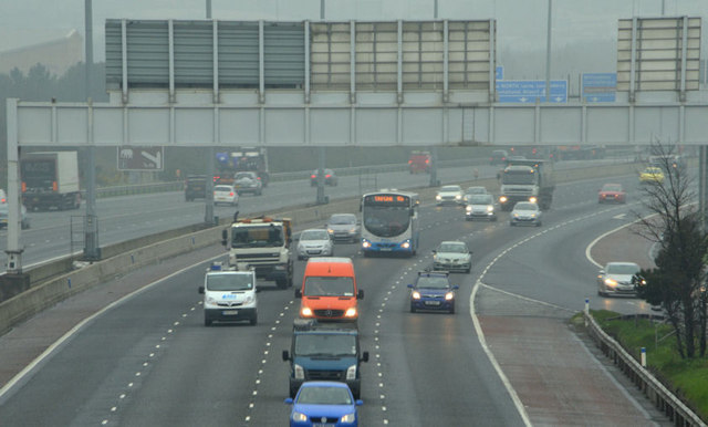
The effects (mainly smog, dust settled on vehicles and difficulties for asthmatics) of the wind-carried dust from the Sahara Desert have made news in the last few days (April 2014). The worst has been in parts of England although there were media reports of the material in NI. Todays Independent recorded Saharan dust and record levels of air pollution will continue to plague the UK today, leading experts to advise schools to keep children indoors in the worst affected parts of England. A perfect storm of dust from the Sahara, emissions from the Continent, low south-easterly winds and domestic pollution has caused air quality to plummet while pollution levels soar in England and Wales. The smog-like conditions are forecast to remain until Friday [4 April 2014]. The dust is explained in this link Link
.
The photographs submitted by me show what might be Sahara dust. I am not a scientist or meteorologist and its quite possible that I am completely wrong.
Fortwilliam roundabout (Jct 1) on the M2 connects the motorway to the Shore Road and, via the Dargan Road to Belfast harbour and the surrounding commercial area. It is busy during working hours but quiet at the weekends.
![Creative Commons Licence [Some Rights Reserved]](https://s1.geograph.org.uk/img/somerights20.gif)
|
· Find out How to reuse this image ·
Share:
|
|||||
| Start a discussion on J3478 | Suggest an update to this image | Contact the contributor | |||
- Grid Square
- J3478, 49 images (more nearby
 )
)
- Photographer
- Albert Bridge (find more nearby)
- Date Taken
- Thursday, 3 April, 2014 (more nearby)
- Submitted
- Thursday, 3 April, 2014
- Geographical Context
- Place (from Tags)
- Subject Location
-
Irish:
 J 344 780 [100m precision]
WGS84: 54:37.9467N 5:55.1490W - Camera Location
-
Irish: J 344 777
- View Direction
- NORTH (about 0 degrees)
Other Tags