2014
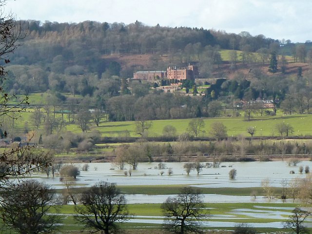
SJ2106 : Powis Castle
taken 10 years ago, near to Welshpool/Y Trallwng, Powys, Wales
This is 1 of 59 images, with title Powis Castle in this square
Powis Castle
Seen across the flooded Severn valley from Leighton churchyard.
The railway line and adjacent A483 Welshpool bypass are on a causeway just beyond the main body of water.
The railway line and adjacent A483 Welshpool bypass are on a causeway just beyond the main body of water.
 Map © Crown Copyright")
TIP: Click the map for more Large scale mapping
- Grid Square
- SJ2106, 469 images (more nearby 🔍)
- Photographer
- Penny Mayes (more nearby)
- Date Taken
- Sunday, 16 February, 2014 (more nearby)
- Submitted
- Saturday, 5 April, 2014
- Subject Location
-
OSGB36:
 SJ 215 063 [100m precision]
WGS84: 52:38.9729N 3:9.6526W - Camera Location
-
OSGB36: SJ 242 059
- View Direction
- WEST (about 270 degrees)