2014
SS4697 : Loughor Estuary from Cilifor Top
taken 10 years ago, 3 km from Pwll, Carmarthenshire/Sir Gaerfyrddin, Wales
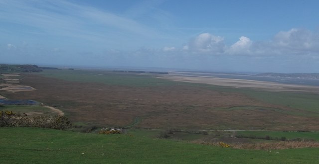
Loughor Estuary from Cilifor Top
A view of the Loughor Estuary from Cilifor Top, site of former forts. The small row of trees in the distance is Whiteford Point. The photo is taken at low tide.
 Map © Crown Copyright")
TIP: Click the map for more Large scale mapping
- Grid Square
- SS4697 (more nearby 🔍)
- Photographer
- Kevin Corcoran (more nearby)
- Date Taken
- Tuesday, 8 April, 2014 (more nearby)
- Submitted
- Friday, 11 April, 2014
- Subject Location
-
OSGB36:
 SS 464 979 [100m precision]
WGS84: 51:39.5477N 4:13.2538W - Camera Location
-
OSGB36: SS 505 924
- View Direction
- Northwest (about 315 degrees)