2014
NS3779 : Carman Hill-fort: line of inner enclosure
taken 10 years ago, near to Alexandria, West Dunbartonshire, Scotland
This is 1 of 5 images, with title Carman Hill-fort: line of inner enclosure in this square
Carman Hill-fort: line of inner enclosure
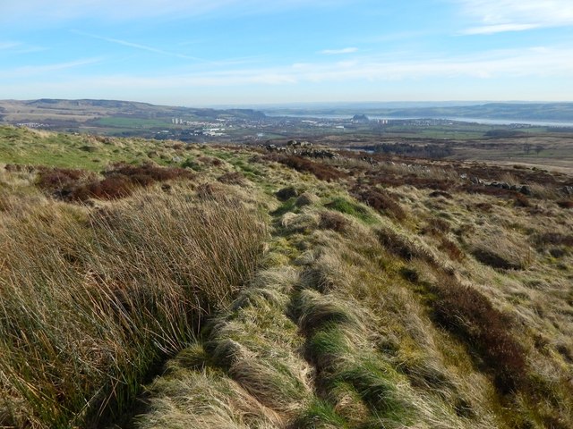
See NS3779 : Ancient hill-fort on Carman Hill for the main description of the hill-fort. Click on the end-note title for related pictures, and see the annotated satellite view linked from the end-note as an index to these pictures and their positions in the fort.
The inner enclosure is best seen at its western end, as shown in the present picture, where it appears as a ridge receding directly from the photographer's position and then curving away to the left. Compare NS3779 : Carman Hill-fort: line of inner enclosure, a view in the opposite direction along the same section of the ridge.
In the right background, Dumbarton Rock Link can be seen on the near shore of the Clyde. The left-hand half of the skyline is taken up by NS4376 : The Long Crags and NS4274 : Dumbuck Quarry.
Other pictures of the inner enclosure:
NS3779 : Carman Hill-fort: line of inner enclosure
NS3779 : Carman Hill-fort: line of inner enclosure
NS3779 : Carman Hill-fort: line of inner enclosure
NS3779 : Carman Hill-fort: line of inner enclosure
Next topic the annexe:
NS3779 : Carman Hill-fort: northern end of annexe
NS3779 : Carman Hill-fort: western wall of annexe
NS3779 : Carman Hill-fort: western wall of annexe
NS3779 : Carman Hill-fort: eastern wall of annexe
NS3779 : Carman Hill-fort: eastern wall of annexe
Previous topic the outer enclosure:
NS3779 : Carman Hill-fort: line of outer enclosure
NS3779 : Carman Hill-fort: line of outer enclosure
NS3779 : Carman Hill-fort: line of outer enclosure
Carman Hill-fort
This large hill-fort see Link
(at Canmore) was identified in 1954 from aerial photographs, and is thought to date from the Early Historic period (Dark Ages). See Link for a Geograph article on the fort. See Link
 Map © Crown Copyright")
TIP: Click the map for more Large scale mapping
- Grid Square
- NS3779, 116 images (more nearby 🔍)
- Photographer
- Lairich Rig (more nearby)
- Date Taken
- Wednesday, 12 March, 2014 (more nearby)
- Submitted
- Thursday, 17 April, 2014
- Subject Location
-
OSGB36:
 NS 3714 7947 [10m precision]
WGS84: 55:58.8296N 4:36.7084W - Camera Location
-
OSGB36: NS 3714 7948
- View Direction
- South-southeast (about 157 degrees)